Beckman's Gasthof

A summary of the Beckman's explorations in our new Tiffin Phaeton.

Thursday, August 31, 2006

Bay of Fundy


Wow! The Bay of Fundy looked just like your 8th grade science book pictures. (Bet Mr. Haggrup would have loved to see this). It was awesome. The information centers scattered throughout Nova Scotia (and all the Canadian provinces) have very informative brochures. Every time we go in and ask for something, they come up with a brochure concerning it. We used the brochure listing the times of the tides so we could arrive at low tide. Of course, with John driving, we arrived within 2 minutes of the low tide. The twice daily tides rise and fall between 39 and 49 ft. in the Parrsboro harbor. Parrsboro is located on the north shore of the Minas Basin on the Bay of Fundy in Nova Scotia. We walked out onto the mud flats and saw the boats that had been stranded by the low tide. The mud flats that were uncovered by the low tide extended out approximately a mile. We figure you really have to plan your time as to when to go out fishing.

The boats are tied up to allow them to just touch bottom at the low tide, as the photo shows. There are large planks laid on the sea floor to allow them to rest on their keels when the water is out.

The photo of Pris next to the dock shows a water depth measure (above her arm). The top mark, above the high water mark, is 14 meters! I assume that is above mean low tide.

We had lunch at a small seafood restaurant right on the harbor and had a great selection of clams, scallops (which they are known for) and other seafood. We did not stay the 6 hours for the high tide but enjoyed a beautiful drive along the Glooscap Trail that followed the coast line along Minas Basin and Cobequid Bay. The countryside consisted of rolling hills and flatlands with very small quaint towns along the way.

There is another phenomenon on the Bay of Fundy called the tidal bore. The incoming high tide creates a wave that goes up the river very rapidly. This tidal bore (or wave) can be anywhere from a ripple to several feet in height. There are many businesses located along the mouth of these rivers that take you out to surf the bore. It lends new meaning to the words “surfs up”.

Tuesday, August 29, 2006

Cape Breton, Novia Scotia


We decided to take a driving tour of the Cape Breton Island and the much heard about Cape Breton Highland Park. Cape Breton Island lies off the northeastern coast of Nova Scotia and can be accessed by a short causeway that was built in 1955. Prior to this, it could only be accessed by ferry. The island is divided into different driving routes but the most famous is the Cabot Trail. This trail (or road) follows the western shore of the island, continues north around the Highland National Park, and goes down the eastern shore of Cape Breton. It took us 6 hours to make the drive. We saw beautiful valleys with apple trees right along side the road, windswept rolling hills and beaches, bogs, and high 1,000 foot cliffs above the ocean. We stopped at a small town that is inhabited by Acadians and had Acadian meat pie (pie crust filled with shredded pork and chicken), mussels, and a lobster salad. We listened to the unique style of Acadian fiddle playing while eating our lunch on the water.

As the photo shows, we had rain off and on, but driving was easy because there were very few cars on the road (and this is the height of the season here). We were told that this is a very popular drive so we were anticipating a lot of traffic. We were not sure if it was the rain or the gas prices that account for the small crowds.

We have been seeing beware of moose signs all throughout the maritime provinces and we finally saw a moose on the side of the road. We were certainly more interested in her, than she was with us.

Novia Scotia


As most of you know, we had aimed for Nova Scotia since we started this trip in early June. On Thursday, August 24 we crossed into the province. Named for New Scotland, it has Scottish, English and French roots. The Acadians we know from Cajun country are the “kicked out” French descendents. Not all of them left, accounting for the French areas throughout the Maritime Provinces.

The "wee lassie" in the photo was waiting for us at the border. She blew a mean pipe!

Most of the driving has been rolling hills, with not that much up and down. The coast also has many coves and harbors, so there are ample fishing fleets and hence, seafood. Mussels, lobsters, clams, oysters and salmon are all available at the local grocery store and at the restaurants. We are sampling all of them.

Friday, August 25, 2006

Shediac, New Brunswick


We woke to a gorgeous sunny day and pulled up stakes (or our jacks) and headed for parts east. We had most of the TransCanadian Highway to ourselves. This part of the highway was particularly good. It had four lanes and was very smooth. We were on a mission to reach the lobster capitol of Canada-Shediac, New Brunswick. Shediac is a town of 4,800 people and located on the Northumberland Strait just off the Gulf of St Lawrence. We got ourselves settled at the Parlee Provincial Park and headed for a short drive into town to search out lobsters. The fish markets were selling lobsters cooked for $10 a pound or we opted to treat ourselves and eat at a restaurant on the water and have all the fixings with our lobster dinner. We both commented on the fact that it was the best lobsters we’ve ever had.

We took a short walk from the campground and walked down to the beach. The beaches are groomed each day and are well maintained. The locals walk to the beach because the entrance fee for day use and parking was $9 (Canadian). The U.S. dollar fares a bit better-that would be 90 cents. Even though the dollar is a bit better, they get you in taxes. All services (not including groceries) have an approximate 15% tax.

Thursday, August 24, 2006

Fredericton, New Brunswick


Sunday, August 20th found us crossing over into the next province of New Brunswick. We decided to head for a provincial park along the water called Mactaquac Provincial Park. We try to drive less than 300 miles and arrive in the early afternoon so as to get a good camping spot. We did not need to worry because the park was only 10% full. We had our pick of large sites in the thick forest right along the water. As in the states, it is easier to find a good camping spot during the week, rather than on the weekend. We had a few slight showers and the weather is cooler. We are now switching to jeans and jackets.

We spent Monday driving into the capitol of New Brunswick, Fredericton. They are set up to be very tourist friendly. There are many tourist centers scattered around the city with great pamphlets describing shopping, restaurants, sites, etc. They gave us a free parking pass for anywhere downtown, coupons for various businesses and they have free WiFi available throughout the city. It’s too bad that we forgot both cameras because they have an old military establishment in town with Canadian mounted police stationed there in full uniform and a changing of the guard ceremony.

The photo is for Jane Wood. She is a moose lover! (She also loves a Seminole, but I refuse to put a photo of one of those on my Blog!)

St-Jean-Port-Joli, Quebec


We awoke today, August 19, to slight showers and decided we would beat the front coming through and head east to Quebec City and beyond. We continued along the Trans Canadian Highway heading east and stopping at a small town on the south side of the St Lawrence Seaway called St-Jean-Port-Joli.

A note to our RV friends. The roads are generally good-2 lanes and many times 4 lanes, (although sometimes very bumpy) and well marked. There are rest stop at about every 50 miles and ample gas available. Our cell phones (Verizon) work all along the Trans Canadian Highway, but we are not using them because it’s 70 cents a minute, both for incoming and outgoing. Many of the campgrounds and parks have 800 numbers that can be dialed for free at phone booths. There is excellent information available at information centers when you enter each province. Each province has its own booklet with information about its provincial parks and camping.

St-Jean-Port-Joli is a small resort town of about 3,000 people. It has small bed and breakfasts and typical French restaurants. We located one grocery store and it was well stocked with everything we needed. All the grocery stores have a large section devoted to deli style meats and cheeses (much larger than Schreiners in Montrose).

We stayed at a private campground just outside of town with full hookups. There were very few out of province campers so our California license plates drew quite a few stares and comments. It did start to sprinkle after dinner so we watched a Bruce Willis movie in French. We were able to get local TV with our TV antenna. It’s the height of corn season, and they even had free cooked corn in the afternoon.

The town was having a kite flying festival so we drove into town to watch the kites flying. As you can see from the photo, it was raining and cool.

Montreal, Canada


We took the Trans Canadian Highway (as good as any interstate in the states) on August 18 and crossed from Ontario Province into Quebec Province. The highway followed the St. Lawrence Seaway up to Montreal. We have noticed that the majority of the cities are located along the Seaway and it is very sparsely populated to the north. We picked a private campground about 10 miles to the east of Montreal in order to avoid the big city traffic. Although we hit L.A. style traffic coming through Montreal, John was very comfortable driving the R.V. and handled it like a pro.

We decided not to venture into Montreal since we will be spending two days here at the end of our cruise. After getting the R.V. hooked up to water, sewer and electricity, we used our trusty tow vehicle (CRV) to drive through the countryside to a small town called Beloeil that was located to the south of us. We had a wonderful French dinner at a lovely restaurant right on the Richelieu River. One of us should have taken French in school because we had some minor difficulties. The waiter was very helpful, but he had to keep going into the kitchen to ask what the word was in English. It turned out that what we thought was veal was really kidneys, and what Pris had ordered was “bambi”. We managed to survive, even though very little English is spoken in the small towns.
Quebec is…….. well, very French. We see only Quebec flags flying (No Canadian flags), guess they have not heard about lung cancer, what dog poop?, why not relieve myself on the side of the highway ?, and ‘Monsieur –this is not Starbucks”. But what wonderful food and oh la la, what sexy women.

Like the photo of Montreal? This is a test to check your alertness. It is something we took in Monument Valley. If you look carefully, you can see John Wayne chasing indians in the background.

Friday, August 18, 2006

Presqu’ile Provincial Park, Ontario


We were happy to leave Niagara Falls, Ontario. The Falls were beautiful, but staying in a private KOA campground is not our cup of tea. It’s true, you do get full hookups (water, electricity, and sewer) but you also get neighbors right next to you. We much prefer large sites in the trees with either babbling brooks (just like Oregon) or a lake or stream. So the Canadian Provincial Parks have our name on them. So on Tuesday the 15th, we drove from Niagara Falls, through Toronto and settled on a Provincial Park outside a small town called Brighton. It is located on the northern shore of Lake Ontario just east of Toronto. We liked the area so much that we stayed 3 days. We had a large campsite in Presquile Provincial Park. The Provincial Parks are well maintained, have large sites that are spaced far apart, and well kept facilities-including some campsites with electricity. In fact, we have found that many of the state and national parks, even in the U.S., have electricity, and some with full hookups. Guess not everyone can have weather like California. It has been strange for us to see tents and tent trailers hooked up to electricity and using fans, TVs, toaster ovens, etc.

The park had lake swimming, many hiking and biking trails and lots of bird watching.

Brighton has been a wonderfully friendly town of about 9,000 people. The groceries have proven to be more expensive than in the states and also the gas. We figure we are spending about $4 a gal for gas. John has found that Crown Royal is cheaper than his beloved Jack. Finally, we are seeing Farmer’s Markets and locally grown produce. The corn is absolutely wonderful. This is also apple growing region.

We’re learning about banking (it pays to call Bank of America before you leave the country or otherwise your cards don’t work) and Verizon charges 70 cents a minute AND has to be notified. So we are learning about calling cards.

The weather has been beautiful. It’s been in the 21-27 degree range (Celcius, of course)-70’s - 80’s and cool at night.

Tuesday, August 15, 2006

Niagara Falls, Ontario


We left Metamora on Sunday, August 13 and headed for the border crossing to Canada at Port Huron. After last week’s terrorist scare, the border crossing was backed up for 30-90 minutes each day we had checked. We had no wait and only took 4-5 minutes to get through Canadian customs.

The rest of the drive to Niagara Falls was uneventful. Every tourist from central Canada seemed to be descending on the place as we arrived. Most of the town is junky, looking like Daytona Beach. We treated ourselves to a nice dinner and opted for a highly rated (AAA) Italian restaurant. In addition to the meal, we had the fun of seeing a large gathering of a “Sopranos” like family having dinner there also.

Monday we were off to see the falls and they are all we expected. And the view from the Canadian side is by far the best. We were also lucky to have the wind blowing away from us, so the mist didn’t soak us. As a point of reference, the boat in the photo is about 100 feet long and has 50-100 people on it!

Jacksonville, Florida


Off to Florida via Detroit Airport for a fun week of wedding activities. Our son John arrived from Phoenix and we celebrated with a rehearsal luau Florida style (hot and humid). Niece Lindsey and Dennis were married in a lovely ceremony. It gave us a chance to visit with all our Florida relatives. The highlight of the trip for John was all the shrimp. We had shrimp fried (many times), boiled, barbequed, blackened, etc. Bubba Gump has nothing on us.

We flew back to Metamora on Wed. the day before the security scare. For once our luck held out.

Metamora, Michigan


On July 29th, we arrived for a 2 week break from RVing to spend time with good friends in Metamora (outside Detroit), and fly to Florida for my niece’s wedding. Our friends Pete and Bonnie live down a dirt road in horse country. They had plenty of space for us to store our RV for our trip to Florida. The Lazy Daze was parked next to the horse barn. It was great fun watching the horses and all the animals on their 26 acre property. We watched deer, Canadian geese, many varieties of birds including turkeys, groundhogs, foxes, etc. It was also a kick to watch the hunt club walk the hounds and train them for fox hunting season.

We have included pictures of the outside of our RV, but we thought we would include a picture of us in the foyer of our RV.

Friday, August 04, 2006

Cheboygan State Park


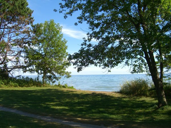
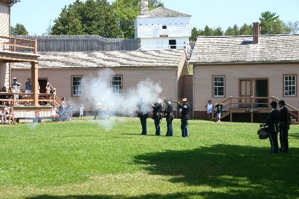
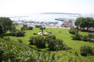
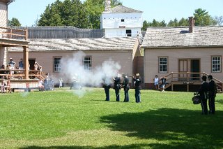
On Wednesday the 26th, we pulled up stacks (or wheels), dumped our tanks in a sprinkling rain and aimed our LD (Lazy Daze) for the Straits of Mackinac and the seven mile bridge across it. We had heard about strong winds and possibly difficulties crossing the bridge. We crossed in the morning when there were no winds, and it was a piece of cake. We called ahead to Cheboygan State Park and verified that they had spots. We have found that someone answers the phone in the parks and actually communicates with you. (As opposed to the California. System.) The state park is located on Lake Huron and only 5 miles out of Cheyboygan (with it’s Wal Mart Supercenter) and about 20 miles from Mackinaw City. We drove into Mackinaw City and took a 30 minute ferry ride out to Mackinac Island. The island is very upscale with lovely “cottages”, grand hotels, bed and breakfasts and shopping. The island is unique since no cars are allowed and everyone moves around by bicycle or horse drawn carriage. We used our hooves instead of the horses. We toured the old fort and visited some of the historic buildings. Back at our campsite and some relaxing and reading under the trees.

P. S. (Travels with Pris-Thank you Sharon G-really enjoyed the book)

Here are some notes of observations for our motorhome friends. We haven’t seen a Bank of America north of Colorado.

The state campgrounds have very nice sites, usually large, well spaced, mostly with trees, good hiking trails and many on lakes and rivers. Many of the sites have been reserved, but they save some for first come first served. Also, if the reserved sites are not taken, you can have them. Some of them have full hookups and most have electricity. They all have water available and dumps. We have not had trouble getting sites. The only problem is that they are off the beaten track if you are trying to make time. We have found the book RV Camping in State Parks by D. J. Davin helpful. It includes the locations, phone numbers and facilities in the parks.

We have used Trailer Life RV Parks, Campground and Services Directory to find private RV parks. We like the CD because it shows the location of each park instead of having to look it up by the city. We’ve found it’s important to have a site with trees for shade since this has been a hot summer and have electrical hookups just in case we need A.C.,

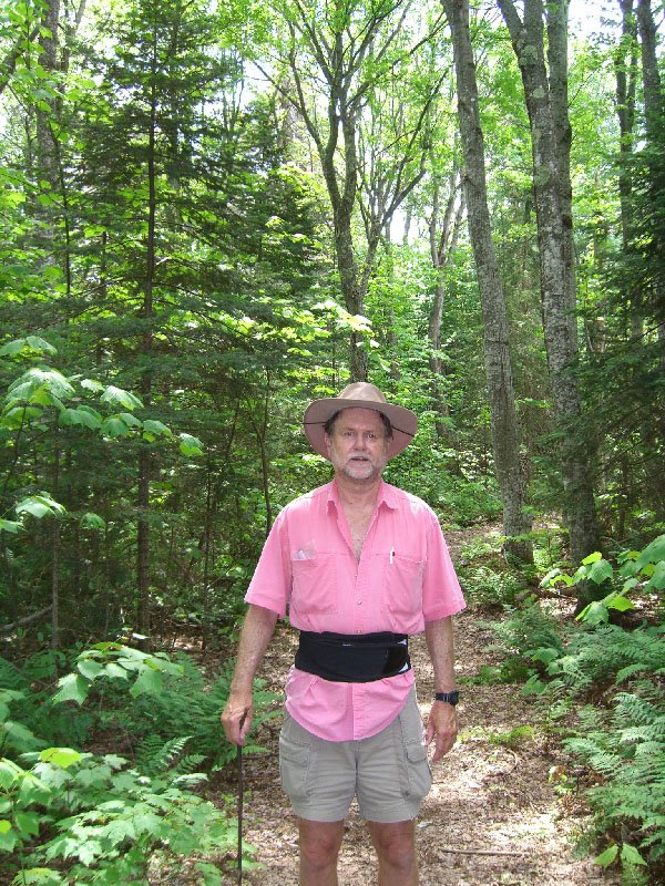
About the bugs. As one Lazy Dazer told us, “I never saw a single mosquito---------they were all married and had kids.” We have seen mosquitoes, knats, and biting flies but they vary by location, temperature and humidity. Most of the time we have had a breeze (since we’ve stuck by the water) so we’ve been lucky. Otherwise, deet helps.

We’ve only used deet stray once.

About navigating: We are also using CoPilot GPS to navigate. You can program the trip in and it shows you where you are, where to go, and includes any landmarks or points of interest that you want. It is not infallible, however. It wanted us to go through a dead end street, jump up to an overpass and did not identify a gravel road. It’s helpful to have AAA maps for a backup. The laptop has worked great, as well as the Bluetooth for finding satellites. The Bluetooth has to be fully charged and the laptop doesn’t like to run the navigation system for both Trailer Life and CoPilot at the same time.

About Shopping. Small towns have limited supplies but larger towns are better and Wal Mart Super Centers have everything. Their locations are pin pointed on the FMCA (Family Motor Coach Association) maps. Gas prices have varied from one town to another, even in the same county.

Muskallonge Lake State Park, Michigan


Monday the 24th we left Ontonagon and headed for Muskallonge Lake State Park. The park is on the very north coast of the upper peninsula (remember, UP) of Michigan, about 100 miles west of the Canadian border. We are enjoying driving on the highways and byways and have not been on an interstate since Montana. This drive was no different, with the many bays off of Lake Superior and the quaint towns.

We have been using the planning and navigation capabilities of two computer programs, Copilot and Trailer Life. They have been a real help in finding our way across the country. Until Monday! The last portion of the trip was scheduled on county road H 58, you know the road between Grand Marais and Deer Park. Five miles out of Grand Marais we came to a sign reading “End of Pavement”. We spent the last 15 miles on a rutted dirt road.

The park is on Muskallonge Lake, which is about 5 miles long by 2 miles wide. Just across the road is Lake Superior. There are nice sandy swimming beaches on both lakes. This park is full of families on their summer vacations. So lots of bikes and boats.

There is a nice hiking tail around the park, as the attached photo shows.

The parks in Michigan have electricity at each campsite, which is different. Some of the electrical boxes require runs of almost 100 feet, which is too much.

There is a large flock of Canadian Geese in Muskallonge Lake. The kids have a great time trying to swim them down.