Beckman's Gasthof

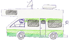
A summary of the Beckman's explorations in our new Tiffin Phaeton.

Thursday, March 29, 2007

Deming, New Mexico (Rock Hound State Park)


The next day (March 22), we drove about 60 miles to the west and Rock Hound State Park, just south of Deming, New Mexico. We knew that Lazy Dazers, Kate and Terry were camped there and we thought it would be fun to connect with them. Beth, another Lazy Dazer, was also there. Thank goodness we called ahead and they saved us a spot. The campground is very popular with rock hound people and retirees. We could see why it’s full most of the time. It’s one of the nicest state parks that we’ve stayed in. (If you like desert.)

The park was located on a southwestern slope of the Little Florida Mountains with a panoramic view of the Florida Mountains to the southwest. The campsites were large, well spaced apart, and offered a view of the gorgeous desert sunsets. The state park had walking trails, a museum, and a botanical garden. Many of the campsites had their own desert gardens. There was an abundance of wildlife and many of the flowers and cacti were blooming. The weather was warm during the day but cool at night and the wind could really blow at times.

The park was a rock hound’s paradise. You could collect rocks anywhere in the park. You were allowed to take out 15 pounds of rocks... Many of the campers had their rock hammers, bags, and some with polishing machines.

We saw lots of retirees and snow birds in New Mexico. They can buy a yearly pass for $225 (non-resident) and stay in any state campground. There is a limit of 21 days stay in any given park, but they only have to leave for 1 day and can return for another 21 days. The weather is great, the living is cheap and the New Mexico State Parks are very nice (so we’ve been told).

We’ve enjoyed exploring the local area. The town of Deming is just 10 miles away and has some great Mexican food restaurants. We love those huevos rancheros, the mild chilies, and the very reasonable prices.

While in Deming we enjoyed a blue grass presentation by the Bost family from Brisbee. Arizona. The seven members of the family gave quite a foot stomping presentation. Mom even had 2 year old William on her back while she played the base.

This area is mainly grassy plains, broken up with some mountain ranges. You have to be careful when driving around, because it is free range with the possibility of cattle crossing the road.

We are also not use to all the border patrol cars, vans, and SUVs. There are check points located on the various roads. We are only 30 miles from the Mexican border. There is also an Aerostat (balloon) tethered up in the sky, that we can see from our campsite. Presumably, it’s there to catch smugglers.

Kate and I did take a day trip down to Palomas, Mexico. It was about a 30 minute drive. We parked the car on the U.S. side and just walked across the border. It’s a very small town that caters to U.S. and Canadian citizens. Many people get their glasses, prescription drugs and even dental work done there. We also did some shopping and picked up some silver jewelry and pottery.

We celebrated John’s 65th birthday with a dinner party in our rig. Thanks to Kate, Terry and Beth for helping us celebrate. As you can see by the picture, it was a bit tight.

Thank you to everyone who sent birthday wishes to the old man.

Tuesday, March 27, 2007

Las Cruces, New Mexico


We headed for Las Cruces, New Mexico on Wed., March 21. We had planned to head north to Alamogordo and then down to Las Cruces, but we noted that we had to go over a pass of over 8600 feet. We did not encounter any mountains on our travels on the east coast or in the south, so it’s been awhile since we’ve had to consult our Mountain Directory West. We gave a call to the closest AAA office and they also advised us to go the southern route.

Route 180 south of Carlsbad was a straight, easy drive through rolling cattle ranches. We passed back into Texas and went over Guadalupe Pass (elevation 5,300 feet) in the Guadalupe Mountains, but it was a slow, easy climb. We continued on our route to El Paso, seeing antelope, javelinas (wild pig ?), and lots of cattle.

We picked up I 10 in El Paso. It surprised us that we could see Mexico just a short distance on the other side of the freeway. This was the community of Juarez, Mexico.

We arrived in Las Cruces and decided to stay at a private RV resort. We must admit that it was very nice. It was a new resort and had lots of amenities that we hadn’t seen before, including phone service available at each site, free morning newspapers, free breakfast, margarita parties, hot tub, etc. We have paid as low as $5 a site, but it usually ranges from $20-$35, but this resort was $43. I guess you pay for all the amenities.

The reason for our stop in Las Cruces was to meet a former colleague of Pris’s, Ed S and Jay. Ed and Pris taught high school biology together for years. We had a wonderful tour of the area and in particular the old town of Mesilla.

Mesilla was founded in the 1850’s and was the largest town in the southern part of New Mexico. It was a major stop for the Butterfield Overland Mail and Stage Line. It is also the place where Billy the Kid was captured and sentenced for the murder of a local sheriff. (He later escaped.) See the picture that shows the courthouse where this occurred.

It’s a walk back in time to see the original buildings, the town square, and the small adobe houses.

We ate dinner at the Double Eagle Restaurant, which is located on the town square. The restaurant is on the national register of historic places and is a former home that had been restored with period antiques. Not only were the surroundings beautiful, but the food was outstanding. We are enjoying the mild (and hot) chilies here.

Wednesday, March 21, 2007

Brantley Lake State Park, Carlsbad, New Mexico


We left San Angelo, Texas on Sunday, March 19 and drove NW through the panhandle plains country. This area was once the domain of the Comanche Indians and was home to the vast, legendary cattle ranches. Our drive took us through Big Springs, Texas, Hobbs, New Mexico to our destination of Carlsbad and the Carlsbad Caverns. We did travel secondary roads and have found them, for the most part, to be well paved and easy to make time on.

Upon reaching Carlsbad, we decided to bypass the private RV parks in Carlsbad . The parks were right off the main road and the sites were close together. Many people prefer the private parks because they have full hookups, laundry and some have WiFi and cable TV.

We drove north about 10 miles from Carlsbad to Brantley Lake State Park. It is located 4.5 miles off the main road and had large sites with lots of space between them. Each site had a table with a cover built over it with a rock wall facing the SW. We presumed the wall was a shelter from the wind. We were located on a hill above Brantley Lake and did experience some winds. Our site was on the edge of the campground with a view of the lake below.

Even though it’s a hot, dry, and windy environment, there is an abundance of wildlife here. We had rabbits, road runners and a variety of different birds in our campsite. There was suppose to be a porcupine in the campground, but we didn’t see him.

Our weather was warm (high 80’s) during the day, but cool (40’s) at night.

On Monday, March 19, we drove 20 miles SW of Carlsbad and visited Carlsbad Caverns National Park. We took the elevator down 750 ft., since it was advised that the path down was steep. The limestone caves are some of the world’s largest. The Big Room is 8 acres and has a 255 foot ceiling. We saw impressive stalagmites, stalactites, soda straws, draperies, etc. (Note the picture. One of us enjoyed this more than the other.)

There are ranger lead tours of many of the caves, but we decided to take the self-guided tour. We used a rented audio guide that explained the formation to us as we walked along. It was a very easy walk on a well maintained walkway. It was a cool 56 degrees and wet in some places, so a jacket and rubber soled walking shoes were a must.

Our Golden Age Passport (age 62 and older) has paid for itself many times over, since it allowed us into the park and caverns for free.

The next day was devoted to reading and short hikes on the trails around the campground. We’ve promised ourselves a little kick back time.

San Angelo State Park, Texas


We left San Antonio, Texas on Thurs., March 15 and drove north 200+ miles to San Angelo, Texas. The area immediately north of San Antonio is called hill country. We did see some low rolling hills but its basically flat traveling north on I 10. It’s very dry country with rocks, cactus and scrub brush.

Our destination was a state park about 10 miles outside the city of San Angelo. The park is divided into the north and south camping areas. We picked the north camping area, called Bald Eagle Creek Area, on the advice of the park volunteer on the phone. We always call ahead to check availability.

The 11 campsites are located under a grove of mature pecan trees in a grassy area. The trees and bushes have lost their leaves for the winter and have not sprouted yet. The campground was never more than half full and this gave us some peaceful reading and hiking time.

The south campground is located on O.C. Fisher Lake, about 9 south miles and around the lake from us, but due to the lack of rainfall it is only at 7% of capacity. It is very dry here. The creek that runs by our campsite is just a trickle. Although our neighbors said they saw a catfish about 2’ long in the creek. They were still trying to hook it when we left. We are off the beaten path, so we are seeing very few RVs from out of state-mainly locals. Part of our campground is an equestrian area where people can camp with their horses.

People are very friendly in the campgrounds. Our last night at Bald Eagle Creek, we were invited by our neighbor’s children for smores and cookie decorating. We have also enjoyed dinner out with fellow campers. It’s fun to talk with people from other parts of the country and compare notes. Campground hosts are particularly friendly and a wealth of information. This is another advantage of state campgrounds over the private ones.

This is definitely cowboy country with lots of feed stores and horse supplies. We see lots of Mexican and Bar B Q restaurants. The menus include steaks, ribs, chicken, beans, and potatoes but not many salads here.

Pris has enjoyed the armadillos wandering through the campground, and John has enjoyed watching the Gator basketball team (winning so far). John signed his life away, and swore to Direct TV that we were on the road, so he gets both the east and west coast feeds. But that’s another story.

Saturday, March 17, 2007

San Antonio, Texas


We left Lake Texana, Texas on Mon. March 12 and headed NW to San Antonio. We experienced one heck of a Texas thunderstorm the night before we left. The thunder was so strong that it caused the RV to shake. Several lightning strikes hit very close to us. We were okay but many spring breakers in flimsy tents had a wet night.

We decided to stay outside San Antonio in a private RV park. We picked the NE side of San Antonio so we could visit the sites downtown, but also the German community of New Braunfels.

We drove a few miles NE to New Braunfels and explored the area that was settled by German immigrants. There is still a strong German influence here. We had one of the best German meals that we’ve ever had (Wiener schnitzel, red cabbage, potato pancakes, sauerkraut, and tap German beer). Eat your heart out Debbie and Fred K.

We headed to downtown San Antonio the next day for a visit to the Alamo and the River Walk along the San Antonio River. It was as beautiful as we remembered.

The Alamo has been beautifully restored and is an inspiration to visit. The defenders of the Alamo held out for 13 days (in 1836) and then all 189 were killed by 4,000 troops lead by Mexico’s General Santa Ana.

The River Walk (Paeso del Rio) is a delight to visit. The river and walkways are located below the downtown city streets. The stone walkways are located on both sides of the river and are lined with restaurants, shops and hotels. There are boat tours available down the river. It is definitely a place to visit.

Severe thunderstorms were predicted again, so when it started raining we decided to cut our tour short and head back to the RV. It’s a good thing we did because later many streets were closed because of flooding. It was another horrendous thunderstorm that night. We don’t like those close lightning strikes.

Sunday, March 11, 2007

Lake Texana State Park, Texas


We had another change in plans. We originally were to have traveled to Corpus Christi and Padre Island, but this is spring break time and we were advised not to go there. So we headed SW of Houston to Lake Texana State Park. The town we were closest to was Edna, about 100 miles SW of Houston on Highway 59.

It’s a lovely park with large grassy sites with many trees, and located on a large lake. There are beautiful birds, deer wandering through the campsites, alligators and a new form of wildlife-poisonous snakes. Pris was watching the campsite as John is driving the RV around and a 2 to 2 ½ foot snake slithers through their campsite. After describing it to the campground host, he decided that it was probably a cottonmouth. Great. Pris kept a close eye on the bushes next to their site the entire time.

We enjoyed our site right on the water and spent most of our time reading and taking short hikes. We like these kick back days. This area is flat and forested, with nice lakes, but the surrounding area is rural with poor small towns with very few facilities.

The state parks are great, but not very convenient for the traveler.

Galveston Bay (Kemah, Texas)


We continued the next day, March 6, on I 10, passing through southern Louisiana and crossing into Texas. We see by the off ramp markers that it’s close to a thousand miles to the western border of Texas. Our destination is the Galveston Bay area which is approximately 100 miles west of the eastern border of Texas. We lived on the Galveston Bay from 1967-1969. John was employed at the Johnson Space Flight Center and Pris taught at two local high schools.

There are no convenient state parks in the area so it was another private RV park. This one we liked. The Kemah RV Park had sites that were spaced fairly reasonably apart, had large oak trees and was not close to any major road and was quiet.

We spent one day visiting the Clear Lake/NASA communities of Clear Lake, Webster, Nassau Bay, Kemah, Seabrook and La Porte. It was fun tracking down our old residences and haunts. The area has grown tremendously since we left. We particularly enjoyed the Kemah area with its boardwalk and outstanding seafood restaurants. This area is known for its boating and fishing. The fish market that we use to buy our shrimp from for 75 cents a pound is still down on the bay.

We drove north of La Porte, approximately 10-15 miles, to visit the San Jacinto Battleground State Historic Site. This is where Sam Houston defeated Mexico’s Santa Ana to gain Texan independence from Mexico. This battle occurred on April 21, 1836 and was concluded in less than 20 minutes. The battle cry was “Remember the Alamo”, which had fallen on March 6. There is a 570 foot limestone obelisk marking the spot. It is said to be the world’s tallest poured concrete column. See the photo.

This entire area (upper Galveston Bay) has lots and lots of oil refineries where they produce our cheap (?) gas. Large oil tankers transport the oil down Galveston Bay to Galveston and out into the Gulf of Mexico.

Galveston Bay (off of LaPorte) is where John and Pris first learned to sail and where they owned their first sailboat-a Flying Scot. John was racing the boat even in those days. We remembered a sail down to Galveston with Jane and Jack M. where we sat adrift with no wind and sweated in the Texas humidity.

We enjoyed meeting up with Marcy and Jack F, friends from our days in the area. We spent a wonderful evening with them at their lovely home on the water, and then a dinner at their yacht club. We were surprised to hear that they do their touring of the country on motorcycles. They are more adventurous than we are.

John enjoyed a lunch with Mark C, a friend from JPL/JSC days and more recently activities in the American Astronautical Society.


Baton Rouge, Louisiana

We left Florida on Mon. March 5 with a change in our itinerary. We had originally planned to travel down the Gulf coast and visit New Orleans. After talking with the campground host, who lives in New Orleans, he advised us not to visit the area. The campgrounds are still heavily occupied with FEMA workers and the facilities are limited (not to mention the crime in New Orleans). Upon leaving Pensacola and driving west along I 10 we saw a fair amount of destruction. There are miles and miles of forest destroyed, mainly from the salt water surge, and not all the facilities are rebuilt yet. We crossed southern Alabama and Mississippi and skirted north of New Orleans on I 12 to end up in Baton Rouge, Louisiana. It’s not as scenic on the interstates but you can sure make time. We spent a night in a private RV park (not our favorite, but convenient to the interstate). That evening we went out for Cajun food. Their food consists of low country boil (red potatoes, corn, crawfish or shrimp), red beans and rice, oysters and a tasty sauce called etouffee. Cajun food is typically spicy. We tend to do our own cooking, but when we visit a metropolitan area, or if the area is known for something unique, we usually eat out. Of course, seafood is always a must for eating out.

Cajuns were originally French people from Nova Scotia called Acadians. They were expelled from Nova Scotia by the British authorities, following a British victory over the French (which war I forget). Most settled in the Louisiana area. Mixing with the Spanish and local Indians created the Cajuns we know today.

Sunday, March 04, 2007

Big Lagoon State Park, Pensacola, Florida


Tuesday, Feb 27, we were off and rolling again. This time we were headed to Big Lagoon State Park west of Pensacola, Florida. The campground is located on a big lagoon, but inland only a few miles from the Gulf beach. We are now seeing much more destruction from past hurricanes. The beach area here was wiped out in hurricane Ivan 3 years ago. There is lots of building going on now.

Our campground had a 16’ water surge and was inundated with boats, refrigerators and trash. It’s in surprisingly good shape now, but the campground host said it was terrible just a year ago. We understand that the campgrounds and facilities to the west of here (Alabama, Mississippi, and Louisiana) are in bad shape. That area was hit by Katrina.

Pensacola and surrounding area has 3 military bases. Pensacola Naval Air Station is just a few miles from our campsite and its flight pattern passes right over the campground. Those jets can really make some noise. It’s been fun to watch them come in. It’s the home to the Blue Angels and we saw them practicing. The base also has a Naval flight museum that is quite impressive.

The highlight or our whole trip was a visit to see Major Freddie K (son of good friends Debbie and Fred from our hometown) who is stationed at Hulburt Field outside Ft. Walton Beach (just an hour’s drive to the east of us). Freddie went out of his way to give us a personal tour of the base. It is the only Air Force special ops base in the U.S. The special ops command was established by President Reagan after the failed rescue attempt of American hostages in Iran. These guys’ job is to fly behind enemy lines, usually at night! Freddie flies a MH 53 (jolly green giant) helicopter and has been to Iraq two times already.

We walked out onto the tarmac and visited one of these helicopters. Look at the photo to see the pilot and copilot. It was a kick. Next, we were on to the building with the simulators. We actually got to fly a C130 troop transport simulator. They are very realistic. The “cockpit” is an actual mockup of the real thing, in a small room. The room is controlled by hydraulic pistons, driven by computers. So when you turn the airplane, the cockpit actually moves. In addition, the views out of the cockpit are computer driven visual displays. They use Goggle maps and can pick any area and practice flying over it. We flew over the Pensacola area and it looked so real. What an experience.

The last stop of the day was a visit to the control tower for the airfield. We took an elevator up 9 stories and got an orientation about the equipment in the tower and how it worked.

You really have to appreciate all these men and women and what they all do for us. A special thanks to Freddie for the tour.

We topped the day off with a visit with our friend Jane M. who lives in Niceville. It’s about a half hour north of Ft. Walton Beach. We got a tour of the area and a lovely dinner at her home. We hope we have convinced her to visit us at Rose Parade time.